
- Start >
- Rivers >
- Waterlevel >
- Bayern >
- Deggendorf >
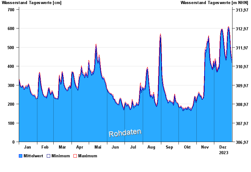
- Chart of year

Chart of year Deggendorf / Donau
Waterlevel from 01.01.2023 to 31.12.2023
- 04.06.2013 Wasserstand: 806 cm
- 15.08.2002 Wasserstand: 745 cm
- 26.05.1999 Wasserstand: 745 cm
- 28.03.1988 Wasserstand: 718 cm
- 26.08.2005 Wasserstand: 709 cm
| Date | Mean value [cm] | Maximum [cm] | Minimum [cm] |
|---|---|---|---|
| 31.12.2023 | 432 | 443 | 418 |
| 30.12.2023 | 458 | 472 | 444 |
| 29.12.2023 | 493 | 513 | 473 |
| 28.12.2023 | 534 | 555 | 514 |
| 27.12.2023 | 575 | 590 | 556 |
| 26.12.2023 | 602 | 609 | 590 |
| 25.12.2023 | 605 | 610 | 593 |
© Bayerisches Landesamt für Umwelt 2024