
- Start >
- Rivers >
- Waterlevel >
- Bayern >
- Chamerau >
- Chart of month

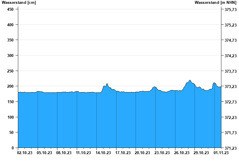
Chart of month Chamerau / Regen
Waterlevel from 02.10.2023 to 01.11.2023
- 13.08.2002 Wasserstand: 681 cm
- 21.12.1993 Wasserstand: 600 cm
- 22.07.1980 Wasserstand: 576 cm
- 01.11.1998 Wasserstand: 556 cm
- 21.03.2002 Wasserstand: 544 cm
| Date | Waterlevel [cm] |
|---|---|
| 01.11.2023 23:45 | 199 |
| 01.11.2023 23:30 | 198 |
| 01.11.2023 23:15 | 197 |
| 01.11.2023 23:00 | 197 |
| 01.11.2023 22:45 | 196 |
| 01.11.2023 22:30 | 197 |
| 01.11.2023 22:15 | 197 |
© Bayerisches Landesamt für Umwelt 2025