
- Start >
- Rivers >
- Waterlevel >
- Bayern >
- Bruggen >
- Chart of month

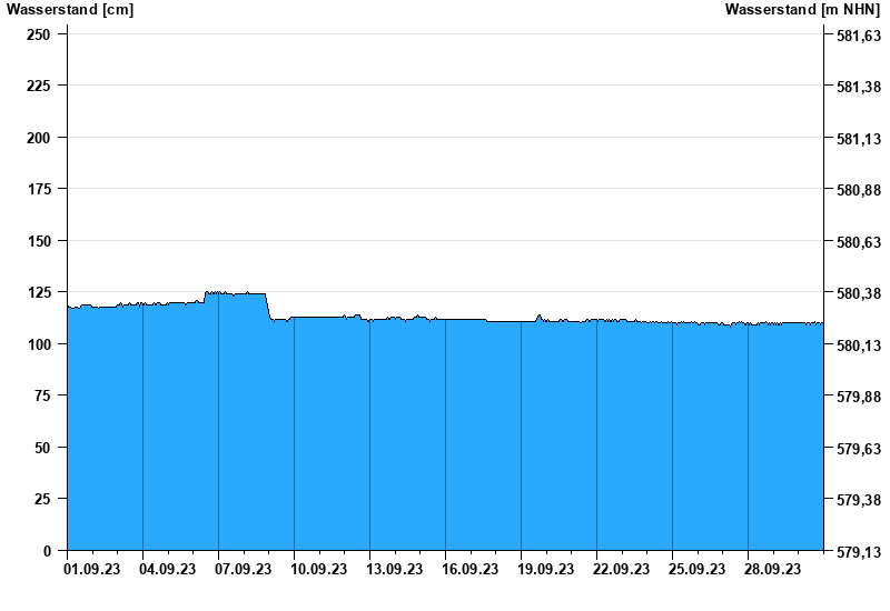
Chart of month Bruggen / Loisach-Isar-Kanal
Waterlevel from 01.09.2023 to 30.09.2023
Störung
Der Pegel wird durch Baumaßnahmen unterhalb beeinflusst (Rückstau). Entsprechend sind die Abflusswerte nicht korrekt
- 26.07.1976 Wasserstand: 310 cm
- 03.06.1976 Wasserstand: 310 cm
- 30.06.1977 Wasserstand: 309 cm
- 05.08.1967 Wasserstand: 308 cm
- 10.05.1967 Wasserstand: 306 cm
| Date | Waterlevel [cm] |
|---|---|
| 01.10.2023 00:45 | 109 |
| 01.10.2023 00:30 | 108 |
| 01.10.2023 00:15 | 109 |
| 01.10.2023 00:00 | 109 |
| 30.09.2023 23:45 | 109 |
| 30.09.2023 23:30 | 109 |
| 30.09.2023 23:15 | 108 |
© Bayerisches Landesamt für Umwelt 2025