
- Start >
- Rivers >
- Waterlevel >
- Bayern >
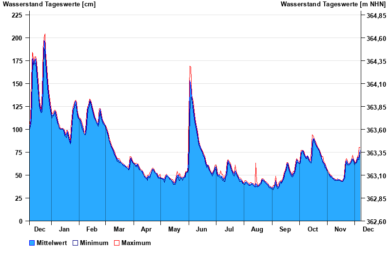
- Beilngries oberh. der Sulz >
- Chart of year

Chart of year Beilngries oberh. der Sulz / Altmühl
Waterlevel from 08.12.2023 to 07.12.2024
- 18.03.1988 Wasserstand: 300 cm
- 03.03.1987 Wasserstand: 289 cm
- 29.03.1988 Wasserstand: 276 cm
- 24.12.1993 Wasserstand: 275 cm
- 15.01.2011 Wasserstand: 271 cm
| Date | Mean value [cm] | Maximum [cm] | Minimum [cm] |
|---|---|---|---|
| 07.12.2024 | 77 | 80 | 75 |
| 06.12.2024 | 70 | 80 | 67 |
| 05.12.2024 | 68 | 69 | 67 |
| 04.12.2024 | 69 | 70 | 67 |
| 03.12.2024 | 65 | 67 | 63 |
| 02.12.2024 | 63 | 63 | 63 |
| 01.12.2024 | 64 | 65 | 61 |
© Bayerisches Landesamt für Umwelt 2025