
- Start >
- Rivers >
- Waterlevel >
- Bayern >
- Bayreuth >
- Chart of month

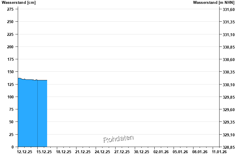
Chart of month Bayreuth / Roter Main
Waterlevel from 12.12.2025 to 11.01.2026
- 23.02.1970 Wasserstand: 304 cm
- 26.01.1995 Wasserstand: 295 cm
- 29.12.1947 Wasserstand: 295 cm
- 02.03.1956 Wasserstand: 290 cm
- 15.01.1968 Wasserstand: 289 cm
| Date | Waterlevel [cm] |
|---|---|
| 16.12.2025 05:45 | 133 |
| 16.12.2025 05:30 | 133 |
| 16.12.2025 05:15 | 133 |
| 16.12.2025 05:00 | 133 |
| 16.12.2025 04:45 | 133 |
| 16.12.2025 04:30 | 133 |
| 16.12.2025 04:15 | 133 |
© Bayerisches Landesamt für Umwelt 2025