
- Start >
- Rivers >
- Waterlevel >
- Bayern >
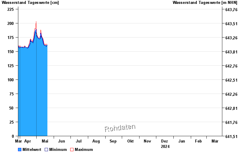
- Bad Tölz B472 >
- Chart of year

Chart of year Bad Tölz B472 / Isar
Waterlevel from 29.03.2024 to 28.03.2025
- 02.06.2013 Wasserstand: 338 cm
- 03.06.2010 Wasserstand: 300 cm
- 31.07.2014 Wasserstand: 299 cm
- 26.07.2017 Wasserstand: 283 cm
- 31.08.2010 Wasserstand: 283 cm
| Date | Mean value [cm] | Maximum [cm] | Minimum [cm] |
|---|---|---|---|
| 05.06.2024 | 241 | 244 | 239 |
| 04.06.2024 | 253 | 266 | 241 |
| 03.06.2024 | 257 | 303 | 234 |
| 02.06.2024 | 238 | 244 | 233 |
| 01.06.2024 | 237 | 260 | 192 |
| 31.05.2024 | 191 | 198 | 182 |
| 30.05.2024 | 180 | 185 | 177 |
© Bayerisches Landesamt für Umwelt 2024