
- Start >
- Rivers >
- Waterlevel >
- Bayern >
- Bad Kissingen Golfplatz >
- Chart of month

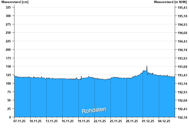
Chart of month Bad Kissingen Golfplatz / Fränkische Saale
Waterlevel from 07.11.2025 to 06.12.2025
- 03.01.2003 Wasserstand: 555 cm
- 14.01.2011 Wasserstand: 508 cm
- 23.02.1970 Wasserstand: 502 cm
- 23.01.1995 Wasserstand: 498 cm
- 07.02.1984 Wasserstand: 491 cm
| Date | Waterlevel [cm] |
|---|---|
| 06.12.2025 23:45 | 119 |
| 06.12.2025 23:30 | 119 |
| 06.12.2025 23:15 | 119 |
| 06.12.2025 23:00 | 119 |
| 06.12.2025 22:45 | 118 |
| 06.12.2025 22:30 | 118 |
| 06.12.2025 22:15 | 119 |
© Bayerisches Landesamt für Umwelt 2025