
- Start >
- Rivers >
- Waterlevel >
- Bayern >
- Amberg >
- Chart of year

Chart of year Amberg / Vils
Waterlevel from 19.04.2024 to 18.04.2025
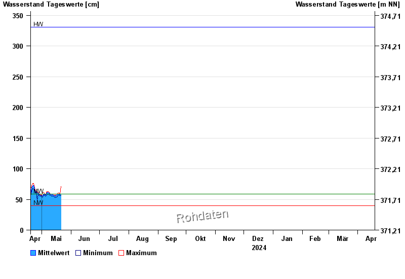
| Date | Mean value [cm] | Maximum [cm] | Minimum [cm] |
|---|---|---|---|
| 15.06.2024 | 63 | 64 | 62 |
| 14.06.2024 | 63 | 65 | 61 |
| 13.06.2024 | 64 | 65 | 62 |
| 12.06.2024 | 64 | 65 | 61 |
| 11.06.2024 | 64 | 66 | 62 |
| 10.06.2024 | 67 | 68 | 65 |
| 09.06.2024 | 69 | 70 | 67 |
© Bayerisches Landesamt für Umwelt 2024