
- Start >
- Groundwater >
- Waterlevel of upper layer >
- Untere Donau >
- WWA LANDSHUT 1A >
- Chart of total period

Chart of total period WWA LANDSHUT 1A
Groundwater levels of the total period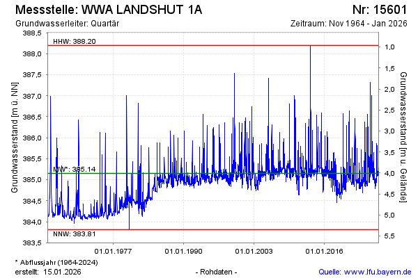
Groundwater level [m above sealevel]: 384.84
Distance to surface [m]: 4.32
Last value from 29.05.2026 10:00
Ground level [m above sealevel]: 389.16
| Date | Groundwater level [m above sealevel] |
|---|---|
| 29.05.2026 | 384.84 |
| 28.05.2026 | 384.84 |
| 27.05.2026 | 384.85 |
| 26.05.2026 | 384.85 |
| 25.05.2026 | 384.85 |
| 24.05.2026 | 384.85 |
| 23.05.2026 | 384.86 |
| 22.05.2026 | 384.86 |
© Bayerisches Landesamt für Umwelt 2026