
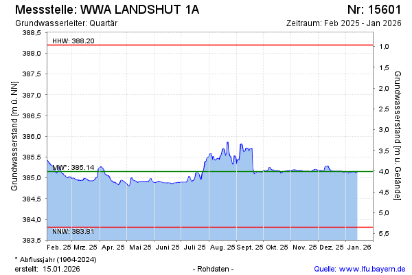
Current data WWA LANDSHUT 1A
Groundwater level [m above sealevel]: 384.85
Distance to surface [m]: 4.31
Last value from 13.07.2026 10:00
Ground level [m above sealevel]: 389.16
| Date | Groundwater level [m above sealevel] |
|---|---|
| 13.07.2026 | 384.85 |
| 12.07.2026 | 384.86 |
| 11.07.2026 | 384.87 |
| 10.07.2026 | 384.90 |
| 09.07.2026 | 384.91 |
| 08.07.2026 | 384.90 |
| 07.07.2026 | 384.91 |
| 06.07.2026 | 384.91 |