Year chart of precipitation UNTERE ISAR SP 64
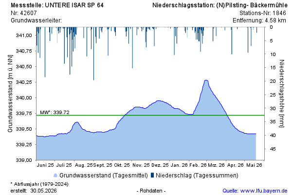
Groundwater level [m above sealevel]: 339,42
Distance to surface [m]: 3,05
Last value from 19.05.2026 08:45
Ground level [m above sealevel]: 342.47

Groundwater level [m above sealevel]: 339,42
Distance to surface [m]: 3,05
Last value from 19.05.2026 08:45
Ground level [m above sealevel]: 342.47