
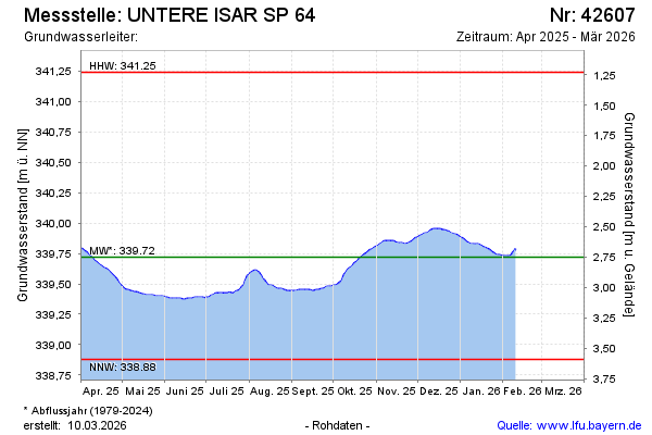
Current data UNTERE ISAR SP 64
Groundwater level [m above sealevel]: 339.42
Distance to surface [m]: 3.05
Last value from 19.05.2026 08:45
Ground level [m above sealevel]: 342.47
| Date | Groundwater level [m above sealevel] |
|---|---|
| 19.05.2026 | 339.42 |
| 18.05.2026 | 339.42 |
| 17.05.2026 | 339.42 |
| 16.05.2026 | 339.42 |
| 15.05.2026 | 339.42 |
| 14.05.2026 | 339.42 |
| 13.05.2026 | 339.42 |
| 12.05.2026 | 339.42 |