
- Start >
- Groundwater >
- Waterlevel of upper layer >
- Untere Donau >
- Postmünster Q2 >
- Chart of total period

Chart of total period Postmünster Q2
Groundwater levels of the total period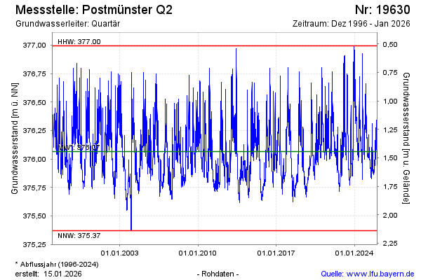
note
Datensammler defekt, derzeit keine Daten.
Groundwater level [m above sealevel]: 375.76
Distance to surface [m]: 1.75
Last value from 21.05.2026 10:00
Ground level [m above sealevel]: 377.51
| Date | Groundwater level [m above sealevel] |
|---|---|
| 21.05.2026 | 375.76 |
| 20.05.2026 | 375.75 |
| 19.05.2026 | 375.74 |
| 18.05.2026 | 375.75 |
| 17.05.2026 | 375.75 |
| 16.05.2026 | 375.76 |
| 15.05.2026 | 375.78 |
| 14.05.2026 | 375.79 |
© Bayerisches Landesamt für Umwelt 2026