Year chart of precipitation Postmünster Q2
note
Datensammler defekt, derzeit keine Daten.
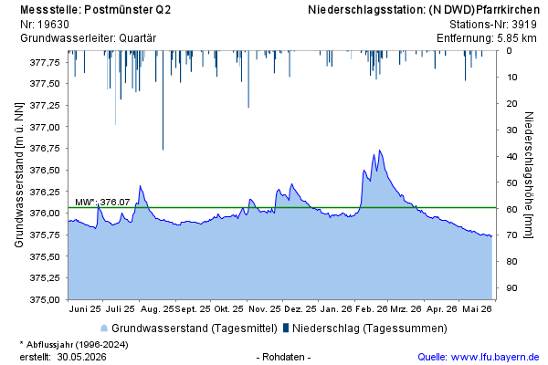
Groundwater level [m above sealevel]: 375,84
Distance to surface [m]: 1,67
Last value from 07.07.2026 10:00
Ground level [m above sealevel]: 377.51

Datensammler defekt, derzeit keine Daten.
Groundwater level [m above sealevel]: 375,84
Distance to surface [m]: 1,67
Last value from 07.07.2026 10:00
Ground level [m above sealevel]: 377.51