
- Start >
- Groundwater >
- Waterlevel of upper layer >
- Untere Donau >
- Oberpöring-Moos-7849 >
- Chart of total period

Chart of total period Oberpöring-Moos-7849
Groundwater levels of the total period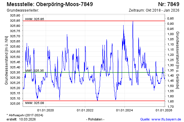
Groundwater level [m above sealevel]: 325.34
Distance to surface [m]: 1.38
Last value from 01.04.2026 13:21
Ground level [m above sealevel]: 326.72
| Date | Groundwater level [m above sealevel] |
|---|---|
| 01.04.2026 | 325.33 |
| 31.03.2026 | 325.33 |
| 30.03.2026 | 325.33 |
| 29.03.2026 | 325.34 |
| 28.03.2026 | 325.34 |
| 27.03.2026 | 325.35 |
| 26.03.2026 | 325.35 |
| 25.03.2026 | 325.36 |
© Bayerisches Landesamt für Umwelt 2026