
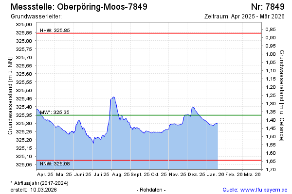
Current data Oberpöring-Moos-7849
Groundwater level [m above sealevel]: 325.22
Distance to surface [m]: 1.5
Last value from 03.06.2026 10:33
Ground level [m above sealevel]: 326.72
| Date | Groundwater level [m above sealevel] |
|---|---|
| 03.06.2026 | 325.22 |
| 02.06.2026 | 325.21 |
| 01.06.2026 | 325.21 |
| 31.05.2026 | 325.20 |
| 30.05.2026 | 325.19 |
| 29.05.2026 | 325.19 |
| 28.05.2026 | 325.19 |
| 27.05.2026 | 325.20 |