
- Start >
- Groundwater >
- Waterlevel of upper layer >
- Untere Donau >
- LANGENISARHOFEN_OP16 >
- Current data

Current data LANGENISARHOFEN_OP16
Groundwater levels of the last 12 months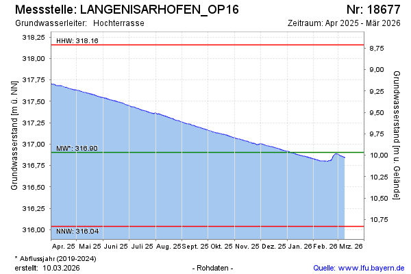
Groundwater level [m above sealevel]: 317.96
Distance to surface [m]: 8.91
Last value from 05.05.2024 08:00
Ground level [m above sealevel]: 326.87
| Date | Groundwater level [m above sealevel] |
|---|---|
| 05.05.2024 | 317.96 |
| 04.05.2024 | 317.95 |
| 03.05.2024 | 317.95 |
| 02.05.2024 | 317.96 |
| 01.05.2024 | 317.95 |
| 30.04.2024 | 317.94 |
| 29.04.2024 | 317.94 |
| 28.04.2024 | 317.94 |
© Bayerisches Landesamt für Umwelt 2024