
- Start >
- Groundwater >
- Waterlevel of upper layer >
- Untere Donau >
- LANGENISARHOFEN_OP16 >
- Chart of total period

Chart of total period LANGENISARHOFEN_OP16
Groundwater levels of the total period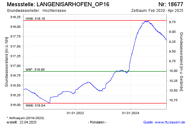
Groundwater level [m above sealevel]: 316.98
Distance to surface [m]: 9.89
Last value from 09.12.2025 08:00
Ground level [m above sealevel]: 326.87
| Date | Groundwater level [m above sealevel] |
|---|---|
| 09.12.2025 | 316.98 |
| 08.12.2025 | 316.98 |
| 07.12.2025 | 316.98 |
| 06.12.2025 | 316.99 |
| 05.12.2025 | 316.99 |
| 04.12.2025 | 316.99 |
| 03.12.2025 | 317.00 |
| 02.12.2025 | 317.00 |
© Bayerisches Landesamt für Umwelt 2025