Year chart of precipitation ETTLINGERMOOS B 404
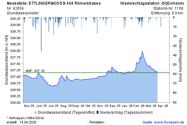
Groundwater level [m above sealevel]: 326,56
Distance to surface [m]: 2,05
Last value from 30.06.2026 10:00
Ground level [m above sealevel]: 328.61

Groundwater level [m above sealevel]: 326,56
Distance to surface [m]: 2,05
Last value from 30.06.2026 10:00
Ground level [m above sealevel]: 328.61