
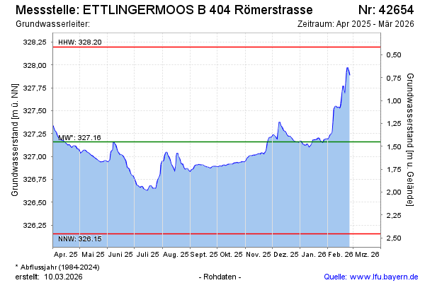
Current data ETTLINGERMOOS B 404
Groundwater level [m above sealevel]: 326.70
Distance to surface [m]: 1.91
Last value from 03.06.2026 09:55
Ground level [m above sealevel]: 328.61
| Date | Groundwater level [m above sealevel] |
|---|---|
| 03.06.2026 | 326.70 |
| 02.06.2026 | 326.70 |
| 01.06.2026 | 326.70 |
| 31.05.2026 | 326.70 |
| 30.05.2026 | 326.71 |
| 29.05.2026 | 326.72 |
| 28.05.2026 | 326.74 |
| 27.05.2026 | 326.76 |