
- Start >
- Groundwater >
- Waterlevel of upper layer >
- Untere Donau >
- Erding-Klettham 1 >
- Chart of total period

Chart of total period Erding-Klettham 1
Groundwater levels of the total period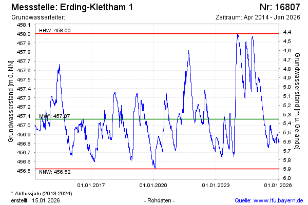
Groundwater level [m above sealevel]: 457.43
Distance to surface [m]: 4.99
Last value from 30.04.2024 09:00
Ground level [m above sealevel]: 462.42
| Date | Groundwater level [m above sealevel] |
|---|---|
| 30.04.2024 | 457.43 |
| 29.04.2024 | 457.43 |
| 28.04.2024 | 457.44 |
| 27.04.2024 | 457.45 |
| 26.04.2024 | 457.46 |
| 25.04.2024 | 457.47 |
| 24.04.2024 | 457.48 |
| 23.04.2024 | 457.49 |
© Bayerisches Landesamt für Umwelt 2024