
- Start >
- Groundwater >
- Waterlevel of upper layer >
- Untere Donau >
- Erding-Klettham 1 >
- Current data

Current data Erding-Klettham 1
Groundwater levels of the last 12 months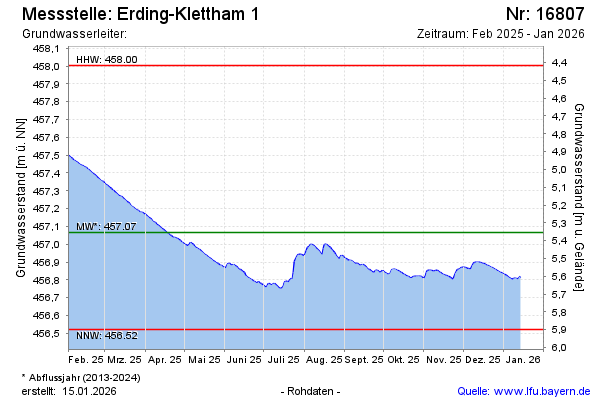
Groundwater level [m above sealevel]: 457.49
Distance to surface [m]: 4.93
Last value from 18.04.2024 09:00
Ground level [m above sealevel]: 462.42
| Date | Groundwater level [m above sealevel] |
|---|---|
| 18.04.2024 | 457.49 |
| 17.04.2024 | 457.48 |
| 16.04.2024 | 457.47 |
| 15.04.2024 | 457.47 |
| 14.04.2024 | 457.46 |
| 13.04.2024 | 457.47 |
| 12.04.2024 | 457.48 |
| 11.04.2024 | 457.49 |
© Bayerisches Landesamt für Umwelt 2024