
- Start >
- Groundwater >
- Waterlevel of upper layer >
- Untere Donau >
- ALLING 814 A >
- Chart of total period

Chart of total period ALLING 814 A
Groundwater levels of the total period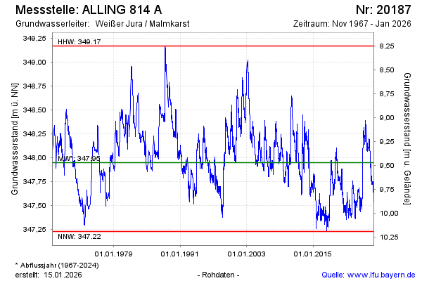
Groundwater level [m above sealevel]: 347.44
Distance to surface [m]: 9.98
Last value from 23.05.2026 10:00
Ground level [m above sealevel]: 357.42
| Date | Groundwater level [m above sealevel] |
|---|---|
| 23.05.2026 | 347.45 |
| 22.05.2026 | 347.45 |
| 21.05.2026 | 347.46 |
| 20.05.2026 | 347.47 |
| 19.05.2026 | 347.48 |
| 18.05.2026 | 347.48 |
| 17.05.2026 | 347.49 |
| 16.05.2026 | 347.50 |
© Bayerisches Landesamt für Umwelt 2026