
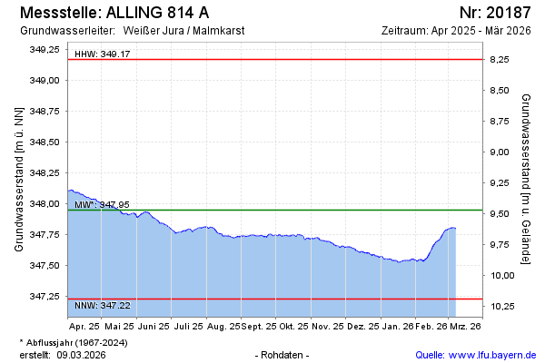
Current data ALLING 814 A
Groundwater level [m above sealevel]: 347.45
Distance to surface [m]: 9.97
Last value from 16.06.2026 10:00
Ground level [m above sealevel]: 357.42
| Date | Groundwater level [m above sealevel] |
|---|---|
| 16.06.2026 | 347.43 |
| 15.06.2026 | 347.44 |
| 14.06.2026 | 347.44 |
| 13.06.2026 | 347.44 |
| 12.06.2026 | 347.43 |
| 11.06.2026 | 347.43 |
| 10.06.2026 | 347.42 |
| 09.06.2026 | 347.42 |