Year chart of precipitation SCHNEEBERG 179
note
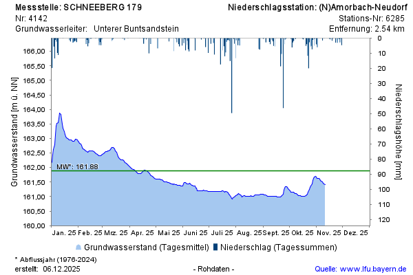
Datenfernübertragung ist ausgefallen. Monatliche Auslesung der Daten.
Groundwater level [m above sealevel]: 161,13
Distance to surface [m]: 26,32
Last value from 17.06.2026 13:00
Ground level [m above sealevel]: 187.45