
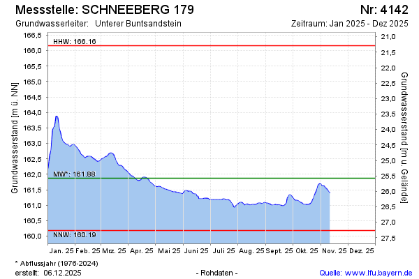
Current data SCHNEEBERG 179
note
Datenfernübertragung ist ausgefallen. Monatliche Auslesung der Daten.
Groundwater level [m above sealevel]: 161.13
Distance to surface [m]: 26.32
Last value from 17.06.2026 13:00
Ground level [m above sealevel]: 187.45
| Date | Groundwater level [m above sealevel] |
|---|---|
| 17.06.2026 | 161.14 |
| 16.06.2026 | 161.14 |
| 15.06.2026 | 161.15 |
| 14.06.2026 | 161.15 |
| 13.06.2026 | 161.16 |
| 12.06.2026 | 161.17 |
| 11.06.2026 | 161.18 |
| 10.06.2026 | 161.20 |