
- Start >
- Groundwater >
- Waterlevel of upper layer >
- Unterer Main >
- N.OESTL. KAHL A. MAIN 3 >
- Year chart of precipitation

Year chart of precipitation N.OESTL. KAHL A. MAIN 3
Groundwater levels of the last 12 months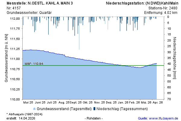
Groundwater level [m above sealevel]: 110,89
Distance to surface [m]: 6,27
Last value from 13.04.2026 10:00
Ground level [m above sealevel]: 117.16
© Bayerisches Landesamt für Umwelt 2026