
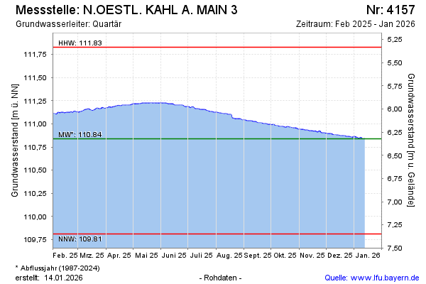
Current data N.OESTL. KAHL A. MAIN 3
Groundwater level [m above sealevel]: 110,82
Distance to surface [m]: 6,34
Last value from 23.07.2026 10:00
Ground level [m above sealevel]: 117.16
| Date | Groundwater level [m above sealevel] |
|---|---|
| 23.07.2026 | 110.83 |
| 22.07.2026 | 110.83 |
| 21.07.2026 | 110.83 |
| 20.07.2026 | 110.82 |
| 19.07.2026 | 110.83 |
| 18.07.2026 | 110.83 |
| 17.07.2026 | 110.83 |
| 16.07.2026 | 110.83 |