
- Start >
- Groundwater >
- Waterlevel of upper layer >
- Obere Donau >
- Rothenburg >
- Chart of total period

Chart of total period Rothenburg
Groundwater levels of the total period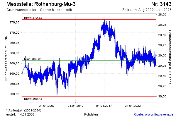
Groundwater level [m above sealevel]: 369.18
Distance to surface [m]: 29.26
Last value from 20.05.2026 13:00
Ground level [m above sealevel]: 398.44
| Date | Groundwater level [m above sealevel] |
|---|---|
| 20.05.2026 | 369.21 |
| 19.05.2026 | 369.24 |
| 18.05.2026 | 369.28 |
| 17.05.2026 | 369.28 |
| 16.05.2026 | 369.34 |
| 15.05.2026 | 369.42 |
| 14.05.2026 | 369.43 |
| 13.05.2026 | 369.38 |
© Bayerisches Landesamt für Umwelt 2026