Year chart of precipitation Rothenburg
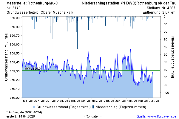
Groundwater level [m above sealevel]: 369,23
Distance to surface [m]: 29,21
Last value from 23.07.2026 13:00
Ground level [m above sealevel]: 398.44

Groundwater level [m above sealevel]: 369,23
Distance to surface [m]: 29,21
Last value from 23.07.2026 13:00
Ground level [m above sealevel]: 398.44