
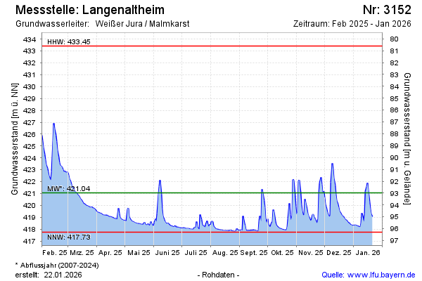
Current data Langenaltheim
Groundwater level [m above sealevel]: 418.25
Distance to surface [m]: 95.78
Last value from 18.06.2026 13:00
Ground level [m above sealevel]: 514.03
| Date | Groundwater level [m above sealevel] |
|---|---|
| 28.06.2026 | 418.05 |
| 27.06.2026 | 418.06 |
| 26.06.2026 | 418.15 |
| 25.06.2026 | 418.18 |
| 24.06.2026 | 418.21 |
| 23.06.2026 | 418.27 |
| 22.06.2026 | 418.23 |
| 21.06.2026 | 418.22 |