Year chart of precipitation Langenaltheim
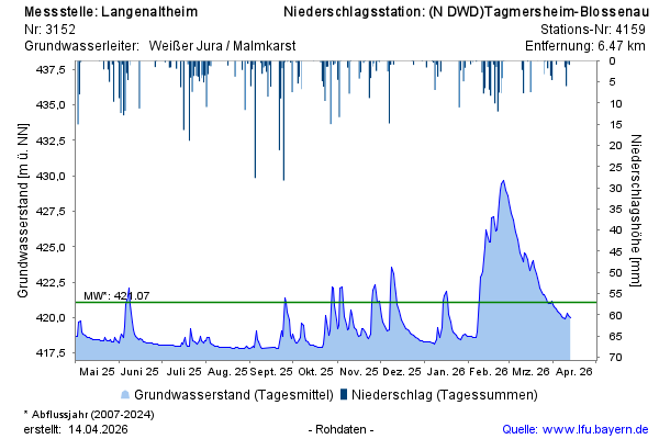
Groundwater level [m above sealevel]: 417,88
Distance to surface [m]: 96,15
Last value from 14.07.2026 13:00
Ground level [m above sealevel]: 514.03

Groundwater level [m above sealevel]: 417,88
Distance to surface [m]: 96,15
Last value from 14.07.2026 13:00
Ground level [m above sealevel]: 514.03