
- Start >
- Groundwater >
- Waterlevel of upper layer >
- Obere Donau >
- KOTHAU 134A >
- Chart of total period

Chart of total period KOTHAU 134A
Groundwater levels of the total period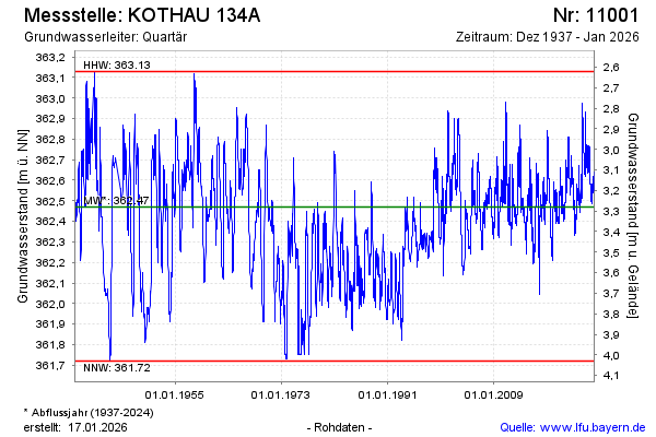
Groundwater level [m above sealevel]: 362.68
Distance to surface [m]: 3.07
Last value from 28.04.2024 10:00
Ground level [m above sealevel]: 365.75
| Date | Groundwater level [m above sealevel] |
|---|---|
| 27.04.2024 | 362.69 |
| 26.04.2024 | 362.69 |
| 25.04.2024 | 362.70 |
| 24.04.2024 | 362.70 |
| 23.04.2024 | 362.70 |
| 22.04.2024 | 362.70 |
| 21.04.2024 | 362.68 |
| 20.04.2024 | 362.68 |
© Bayerisches Landesamt für Umwelt 2024