
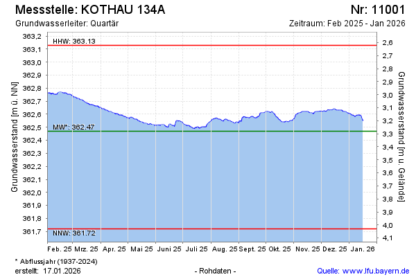
Current data KOTHAU 134A
Groundwater level [m above sealevel]: 362.48
Distance to surface [m]: 3.27
Last value from 24.06.2026 10:00
Ground level [m above sealevel]: 365.75
| Date | Groundwater level [m above sealevel] |
|---|---|
| 28.06.2026 | 362.46 |
| 27.06.2026 | 362.46 |
| 26.06.2026 | 362.47 |
| 25.06.2026 | 362.47 |
| 24.06.2026 | 362.48 |
| 23.06.2026 | 362.48 |
| 22.06.2026 | 362.49 |
| 21.06.2026 | 362.49 |