
- Start >
- Groundwater >
- Waterlevel of upper layer >
- Obere Donau >
- HELFENBRUNN 300 >
- Year chart of precipitation

Year chart of precipitation HELFENBRUNN 300
Groundwater levels of the last 12 months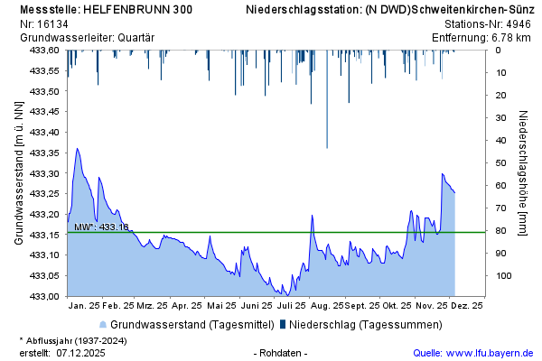
Groundwater level [m above sealevel]: 433,03
Distance to surface [m]: 1,32
Last value from 20.05.2026 09:00
Ground level [m above sealevel]: 434.35
© Bayerisches Landesamt für Umwelt 2026