
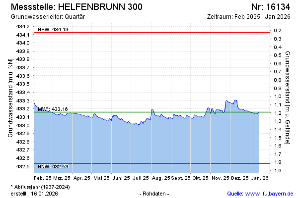
Current data HELFENBRUNN 300
note
Momentan können Messdaten nicht aktualisiert werden, das sich das Gerät bei der Reparatur befindet. Fehlende Messwerte werden später aktualisiert. Wir bitten um Verständnis.
Groundwater level [m above sealevel]: 432.99
Distance to surface [m]: 1.36
Last value from 04.07.2026 09:00
Ground level [m above sealevel]: 434.35
| Date | Groundwater level [m above sealevel] |
|---|---|
| 04.07.2026 | 433.00 |
| 03.07.2026 | 433.00 |
| 02.07.2026 | 433.02 |
| 01.07.2026 | 433.01 |
| 30.06.2026 | 432.98 |
| 29.06.2026 | 432.97 |
| 28.06.2026 | 432.97 |
| 27.06.2026 | 432.97 |