
- Start >
- Groundwater >
- Waterlevel of upper layer >
- Obere Donau >
- FELDGEDING Q 13 >
- Chart of total period

Chart of total period FELDGEDING Q 13
Groundwater levels of the total period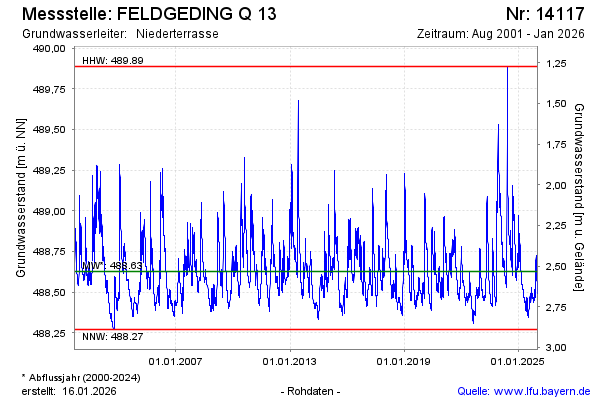
Groundwater level [m above sealevel]: 488.63
Distance to surface [m]: 2.53
Last value from 08.12.2025 09:00
Ground level [m above sealevel]: 491.16
| Date | Groundwater level [m above sealevel] |
|---|---|
| 08.12.2025 | 488.63 |
| 07.12.2025 | 488.62 |
| 06.12.2025 | 488.63 |
| 05.12.2025 | 488.63 |
| 04.12.2025 | 488.64 |
| 03.12.2025 | 488.65 |
| 02.12.2025 | 488.65 |
| 01.12.2025 | 488.66 |
© Bayerisches Landesamt für Umwelt 2025