
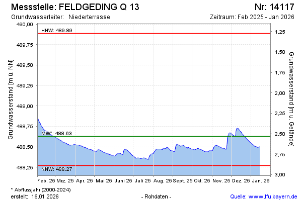
Current data FELDGEDING Q 13
Groundwater level [m above sealevel]: 488.31
Distance to surface [m]: 2.85
Last value from 13.07.2026 09:00
Ground level [m above sealevel]: 491.16
| Date | Groundwater level [m above sealevel] |
|---|---|
| 13.07.2026 | 488.32 |
| 12.07.2026 | 488.32 |
| 11.07.2026 | 488.32 |
| 10.07.2026 | 488.33 |
| 09.07.2026 | 488.33 |
| 08.07.2026 | 488.34 |
| 07.07.2026 | 488.34 |
| 06.07.2026 | 488.34 |