
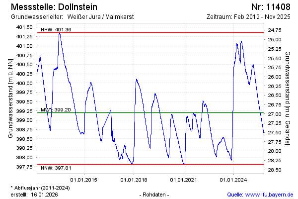
Chart of total period Dollnstein
note
Datenübertragung Defekt. Zeitreihe wird mit Kontrollpunkten erzeugt.
Groundwater level [m above sealevel]: 398.78
Distance to surface [m]: 27.39
Last value from 14.07.2026 09:00
Ground level [m above sealevel]: 426.17
| Date | Groundwater level [m above sealevel] |
|---|---|
| 14.07.2026 | 398.78 |
| 13.07.2026 | 398.79 |
| 12.07.2026 | 398.79 |
| 11.07.2026 | 398.80 |
| 10.07.2026 | 398.81 |
| 09.07.2026 | 398.82 |
| 08.07.2026 | 398.83 |
| 07.07.2026 | 398.83 |