
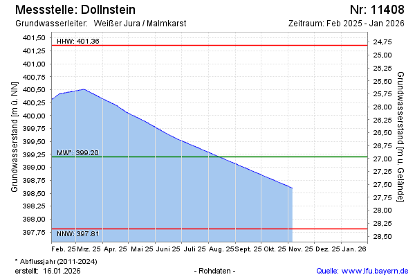
Current data Dollnstein
note
Datenübertragung Defekt. Zeitreihe wird mit Kontrollpunkten erzeugt.
Groundwater level [m above sealevel]: 398.87
Distance to surface [m]: 27.3
Last value from 01.07.2026 09:00
Ground level [m above sealevel]: 426.17
| Date | Groundwater level [m above sealevel] |
|---|---|
| 01.07.2026 | 398.88 |
| 30.06.2026 | 398.88 |
| 29.06.2026 | 398.88 |
| 28.06.2026 | 398.89 |
| 27.06.2026 | 398.90 |
| 26.06.2026 | 398.90 |
| 25.06.2026 | 398.91 |
| 24.06.2026 | 398.92 |