
- Start >
- Groundwater >
- Waterlevel of upper layer >
- Obere Donau >
- ALTENDORF D 19 >
- Chart of total period

Chart of total period ALTENDORF D 19
Groundwater levels of the total period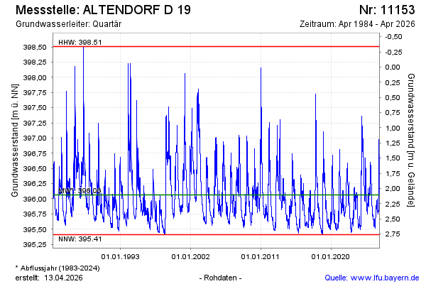
Groundwater level [m above sealevel]: 395.70
Distance to surface [m]: 2.47
Last value from 22.05.2026 09:00
Ground level [m above sealevel]: 398.17
| Date | Groundwater level [m above sealevel] |
|---|---|
| 22.05.2026 | 395.71 |
| 21.05.2026 | 395.71 |
| 20.05.2026 | 395.72 |
| 19.05.2026 | 395.72 |
| 18.05.2026 | 395.73 |
| 17.05.2026 | 395.73 |
| 16.05.2026 | 395.74 |
| 15.05.2026 | 395.74 |
© Bayerisches Landesamt für Umwelt 2026