
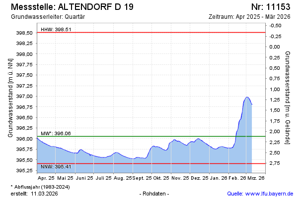
Current data ALTENDORF D 19
Groundwater level [m above sealevel]: 395.58
Distance to surface [m]: 2.59
Last value from 24.06.2026 09:00
Ground level [m above sealevel]: 398.17
| Date | Groundwater level [m above sealevel] |
|---|---|
| 29.06.2026 | 395.56 |
| 28.06.2026 | 395.56 |
| 27.06.2026 | 395.57 |
| 26.06.2026 | 395.57 |
| 25.06.2026 | 395.58 |
| 24.06.2026 | 395.58 |
| 23.06.2026 | 395.59 |
| 22.06.2026 | 395.59 |