
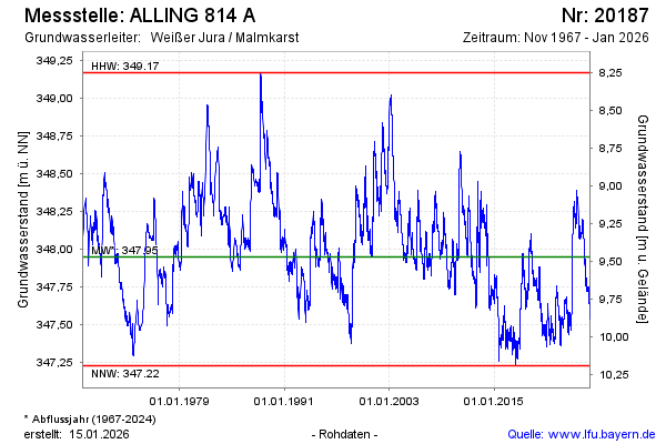
Chart of total period ALLING 814 A
Groundwater level [m above sealevel]: 347.28
Distance to surface [m]: 10.14
Last value from 13.07.2026 10:00
Ground level [m above sealevel]: 357.42
| Date | Groundwater level [m above sealevel] |
|---|---|
| 13.07.2026 | 347.30 |
| 12.07.2026 | 347.30 |
| 11.07.2026 | 347.30 |
| 10.07.2026 | 347.33 |
| 09.07.2026 | 347.34 |
| 08.07.2026 | 347.35 |
| 07.07.2026 | 347.35 |
| 06.07.2026 | 347.35 |