
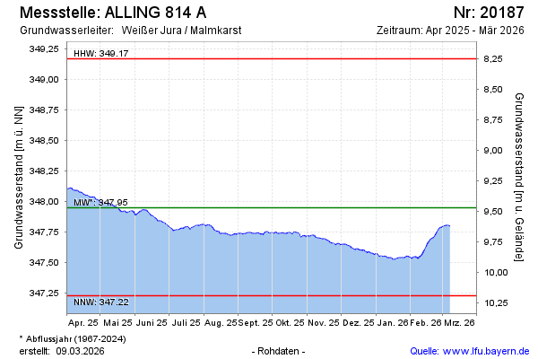
Current data ALLING 814 A
Groundwater level [m above sealevel]: 347.36
Distance to surface [m]: 10.06
Last value from 24.06.2026 10:00
Ground level [m above sealevel]: 357.42
| Date | Groundwater level [m above sealevel] |
|---|---|
| 25.06.2026 | 347.33 |
| 24.06.2026 | 347.35 |
| 23.06.2026 | 347.34 |
| 22.06.2026 | 347.36 |
| 21.06.2026 | 347.36 |
| 20.06.2026 | 347.38 |
| 19.06.2026 | 347.41 |
| 18.06.2026 | 347.43 |