
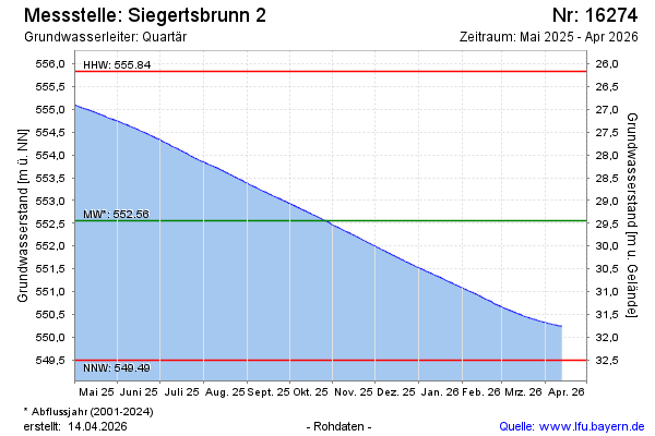
Current data Siegertsbrunn 2
Groundwater level [m above sealevel]: 549.62
Distance to surface [m]: 32.38
Last value from 24.06.2026 10:00
Ground level [m above sealevel]: 582.00
| Date | Groundwater level [m above sealevel] |
|---|---|
| 28.06.2026 | 549.59 |
| 27.06.2026 | 549.59 |
| 26.06.2026 | 549.60 |
| 25.06.2026 | 549.61 |
| 24.06.2026 | 549.62 |
| 23.06.2026 | 549.63 |
| 22.06.2026 | 549.64 |
| 21.06.2026 | 549.65 |