
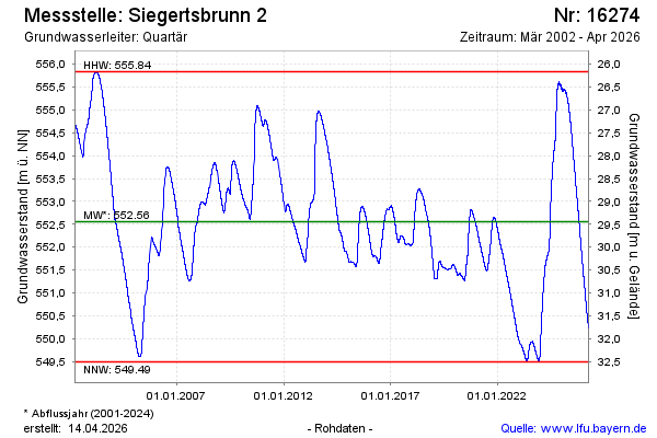
Chart of total period Siegertsbrunn 2
Groundwater level [m above sealevel]: 549,35
Distance to surface [m]: 32,65
Last value from 23.07.2026 10:00
Ground level [m above sealevel]: 582.00
| Date | Groundwater level [m above sealevel] |
|---|---|
| 23.07.2026 | 549.35 |
| 22.07.2026 | 549.36 |
| 21.07.2026 | 549.37 |
| 20.07.2026 | 549.38 |
| 19.07.2026 | 549.38 |
| 18.07.2026 | 549.39 |
| 17.07.2026 | 549.40 |
| 16.07.2026 | 549.41 |