
- Start >
- Groundwater >
- Waterlevel of upper layer >
- Isar >
- Pumpstation Feldolling B6G >
- Year chart of precipitation

Year chart of precipitation Pumpstation Feldolling B6G
Groundwater levels of the last 12 months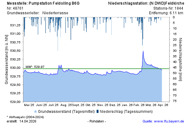
Groundwater level [m above sealevel]: 530,10
Distance to surface [m]: 0,73
Last value from 07.03.2026 07:00
Ground level [m above sealevel]: 530.83
© Bayerisches Landesamt für Umwelt 2026