
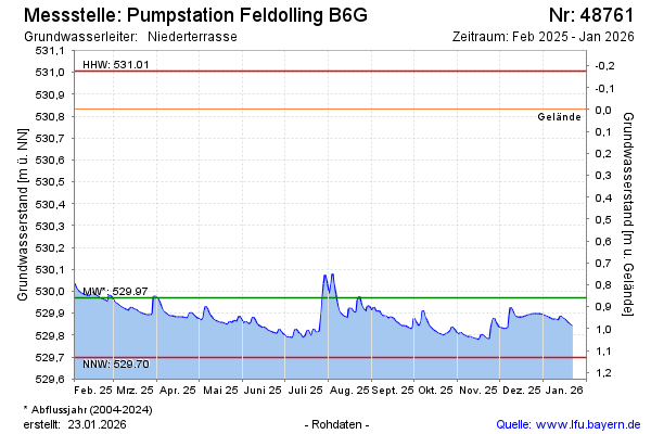
Current data Pumpstation Feldolling B6G
Groundwater level [m above sealevel]: 529.79
Distance to surface [m]: 1.0400000000001
Last value from 13.07.2026 07:00
Ground level [m above sealevel]: 530.83
| Date | Groundwater level [m above sealevel] |
|---|---|
| 13.07.2026 | 529.79 |
| 12.07.2026 | 529.79 |
| 11.07.2026 | 529.80 |
| 10.07.2026 | 529.80 |
| 09.07.2026 | 529.81 |
| 08.07.2026 | 529.81 |
| 07.07.2026 | 529.82 |
| 06.07.2026 | 529.83 |