
- Start >
- Groundwater >
- Waterlevel of upper layer >
- Isar >
- Niederpoering B 97 >
- Chart of total period

Chart of total period Niederpoering B 97
Groundwater levels of the total period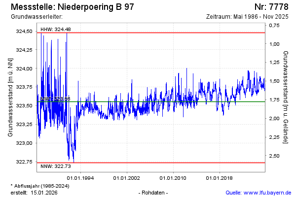
Groundwater level [m above sealevel]: 323.75
Distance to surface [m]: 1.58
Last value from 20.01.2026 14:50
Ground level [m above sealevel]: 325.33
| Date | Groundwater level [m above sealevel] |
|---|---|
| 20.01.2026 | 323.75 |
| 19.01.2026 | 323.75 |
| 18.01.2026 | 323.75 |
| 17.01.2026 | 323.75 |
| 16.01.2026 | 323.76 |
| 15.01.2026 | 323.76 |
| 14.01.2026 | 323.76 |
| 13.01.2026 | 323.75 |
© Bayerisches Landesamt für Umwelt 2026