
- Start >
- Groundwater >
- Waterlevel of upper layer >
- Isar >
- Niederpoering B 97 >
- Current data

Current data Niederpoering B 97
Groundwater levels of the last 12 months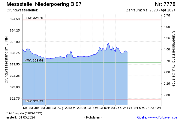
Groundwater level [m above sealevel]: 323.75
Distance to surface [m]: 1.58
Last value from 13.03.2026 11:45
Ground level [m above sealevel]: 325.33
| Date | Groundwater level [m above sealevel] |
|---|---|
| 13.03.2026 | 323.75 |
| 12.03.2026 | 323.75 |
| 11.03.2026 | 323.75 |
| 10.03.2026 | 323.75 |
| 09.03.2026 | 323.75 |
| 08.03.2026 | 323.76 |
| 07.03.2026 | 323.76 |
| 06.03.2026 | 323.77 |
© Bayerisches Landesamt für Umwelt 2026